All Products › ULTRIS X20 Plus Hyperspectral Video Camera
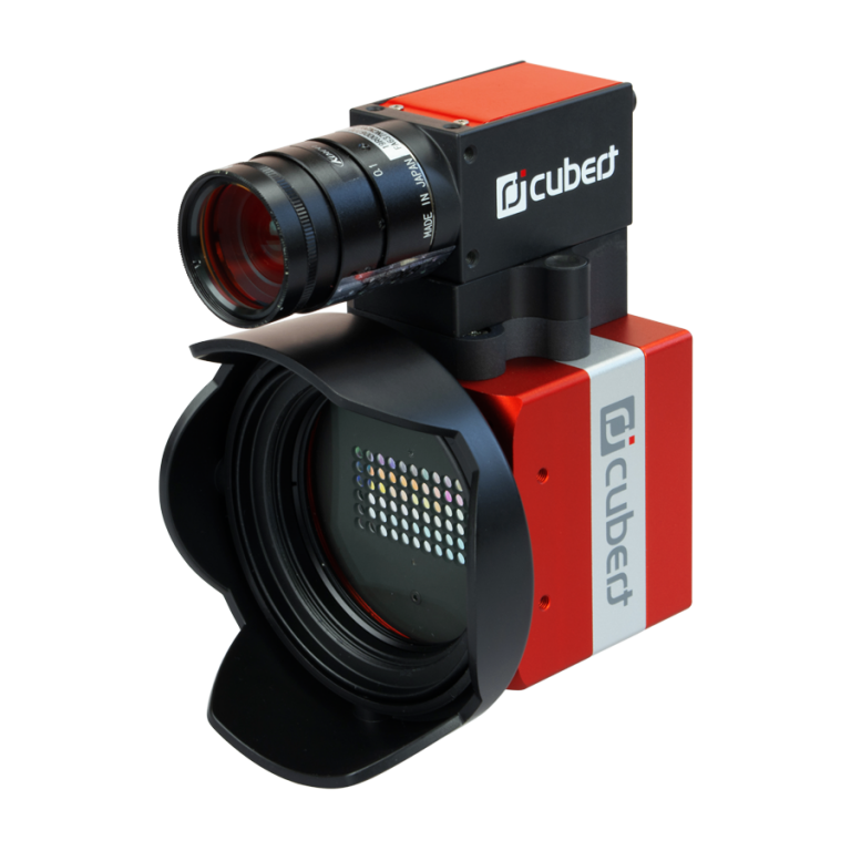
ULTRIS X20 Plus Hyperspectral Video Camera
The award-nominated 3D hyperspectral light field cameras ULTRIS 20 and ULTRIS 20 Plus have been upgraded to include a wavelength range of 350-1000nm enabling UV-VIS-NIR coverage.
Building on the success of the ULTRIS 20 and ULTRIS 20 Plus, the ULTRIS X20 expands the wavelength range from 450-850nm to 350- 1000nm, thereby including the UV spectrum and making UV-VIS-NIR coverage possible.
With a constant FWHM of 10nm across all channels, over 160 spectral bands compared to the previous 100 plus, and a native image resolution of 410×410 pixels (combined with the pan sensor on the ULTRIS X20 Plus model over 1800×1800 pixels is possible), the ULTRIS X20 takes hyperspectral imaging to new heights, enabling even more applications.
The Highest Resolution
3.5M (pansharpened)
Specifications:
Dual-Sensor Technology: Integrated hyperspectral + 5 MP panchromatic sensor for advanced pansharpened aerial mapping
Spatial & Spectral Resolution: 1886 × 1886 px (pan), 164 bands, 350–1000 nm, constant 10 nm FWHM
Imaging Performance: Light field snapshot imaging with global shutter for distortion-free data capture
Data Output & Processing: ENVI & TIFF export, radiance/reflectance workflows, GPS metadata for seamless GIS and stitching integration
Drone Integration: 630 g payload, compact form factor for versatile UAV and aerial mapping platforms

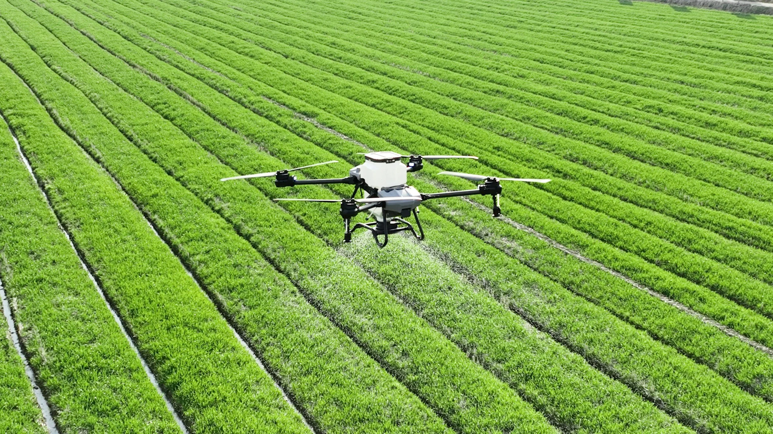
Its compact, lightweight design and real-time snapshot imaging make it perfect for drone-based aerial mapping and remote sensing, delivering precise data on vegetation health, water quality, and land surface conditions.
Aerial Mapping & Remote Sensing

Its compact design and real-time hyperspectral imaging make it ideal for factory inspection and food quality monitoring, enabling rapid, contact-free analysis of freshness, contaminants, and product consistency.
Inspection for Food & Manufacturing
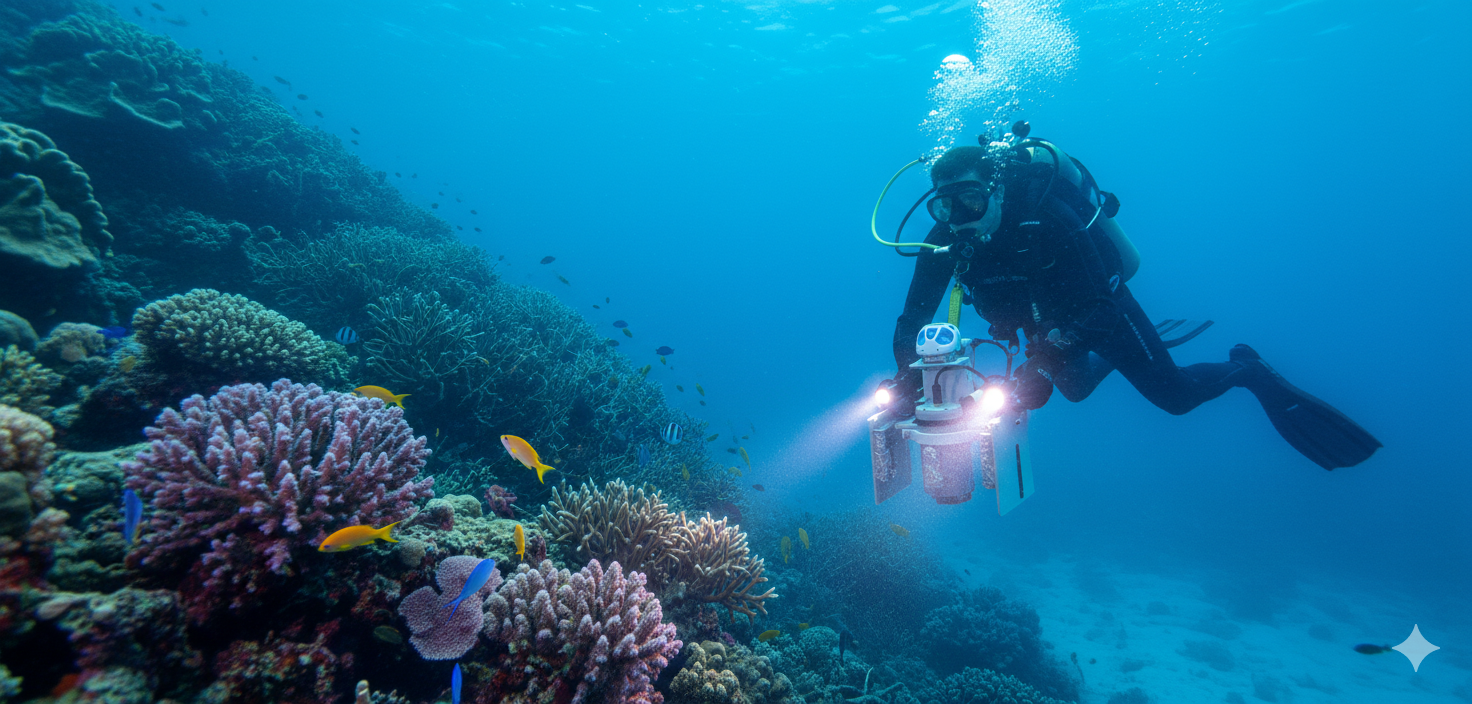
Its lightweight design and real-time hyperspectral imaging make it ideal for marine and ocean applications, providing rapid, contact-free analysis of water quality, algal blooms, and coastal ecosystem health.
Marine & Ocean Monitoring
Its compact, high-resolution hyperspectral imaging enables rapid, non-invasive analysis in biomedical and life science applications, supporting tissue diagnostics, cellular studies, and real-time spectral monitoring.
Biomedical & Life Science Imaging
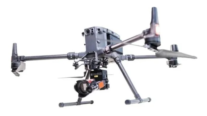
Drone Integration & Cubert ULTRIS Software
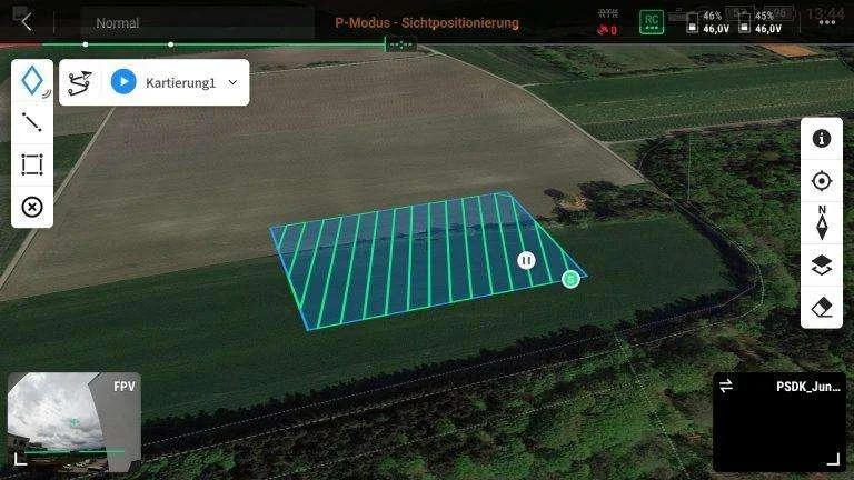
The ULTRIS X20 Plus is compatible with virtually any drone platform and can operate in time-lapse mode or be directly triggered during flight. Mounted to a gimbal with an integrated Windows-based mini-computer running Cubert ULTRIS software, the system records hyperspectral data in real time while embedding precise GPS metadata into every file for accurate georeferencing and aerial mapping workflows.
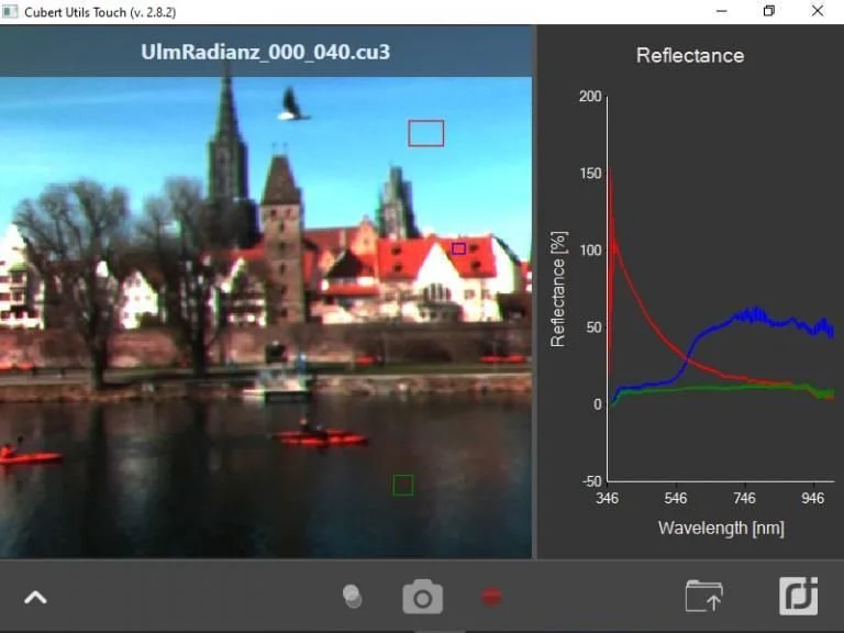
Cubert ULTRIS software enables complete hyperspectral data processing—from raw data to reflectance and radiance—while supporting hyperspectral video capture up to 8 Hz. Users can process live data streams or recorded image cubes, apply spectral indices such as NDVI and CAI, and run custom plug-ins or real-time classification algorithms. Exported datasets in ENVI, TIFF, or Multi-TIFF formats integrate seamlessly with standard GIS and mapping software, including pansharpening workflows.
CUVIS Software
Built on proprietary light field architecture, this next-generation snapshot hyperspectral camera captures full 3D spectral data cubes instantly — without pushbroom scanning, mechanical movement, or filter shifting. High spatial and spectral resolution combined with consistent FWHM performance delivers clean, quantitative UV–VIS–NIR data ready for real-time analysis. Integrated hyperspectral software enables reflectance and radiance processing, spectral indexing, classification, and export to scientific formats such as ENVI and TIFF, making it an ideal solution for research, industrial inspection, defense, environmental monitoring, and airborne remote sensing applications.